Precision in Every Measurement
We deliver precise, actionable surveying data by blending expertise with the latest technology. Our professional surveyors are problem solvers, constantly refining methods to deliver optimal solutions. We organize, visualize and analyze data from geographic and business perspectives, transforming raw information into valuable insight. Our skilled team of land surveyors, field crews and AutoCAD technicians meets diverse client needs across industrial, commercial and residential projects.
- Residential & Commercial Developments
- Public Utilities Improvements, Upgrades & Studies
- Site Development & Planning
- Roadway Improvements
- Sidewalks & Green Space Improvements
- Well Locations & Pipelines
- Levees & Flood Protection
- Coastal Areas
Boundary & Land Title
Providence provides reliable boundary and land title surveys to support property transactions, development and owner verification. We also help stakeholders understand and identify property characteristics and features and perform property records research to ensure clear, precise documentation. With a commitment to accuracy, we deliver the detailed insights needed for informed decision-making.
- Builder’s Packages
- ALTA/ACSM (Land Title) Surveys
- Mortgage Surveys
- Elevation Certificates
- No-Work Affidavit
- Property Records Research
Topographic Surveys
We provide precise topographic surveys to support development, infrastructure improvements and environmental restoration. With expertise spanning ALTA/NSPS to drainage systems, we offer specialized services such as slope stability analyses, stockpile monitoring, as-built surveys and coastal and marsh restoration assessments. Whether for planning, design or construction, our surveys offer the accuracy and detail needed for success.
- ALTA/NSPS Surveys
- Corridor/Infrastructure Surveys
- Slope Stability Analysis
- Stockpile Slope Monitoring & Quantities
- As-Built Surveys
- Drainage Surveys
- Coastal & Ecological Restoration
Aerial LiDAR & Photogrammetric
Providence leverages advanced aerial LiDAR and photogrammetry to deliver high-precision surveying solutions for topographic mapping, as-built documentation and construction progress tracking.
- Topographic Surveys
- As-Built Surveys
- Stockpile Quantity Surveys
- Construction Layout
Construction Layout Services
Our construction layout surveying services can ensure that a project is built according to the design and architectural guidelines. Our process includes interpreting plans, calculating survey points, staking and verification. To provide a road map for site improvement, we also assist with permit drawings and applications, delivering reliable data to keep projects on track and in compliance with regulatory requirements.
- Pipeline
- Roadway
- Drainage, Sewer & Utility
- Subdivisions, Buildings & Infrastructure
- Permit Drawings & Applications
Hydrographic/Bathymetric
To support waterway and infrastructure projects, our services include magnetometer surveys, bathymetric mapping and pipeline waterway crossings, using advanced single-beam echo sounder technology. We provide accurate underwater data to ensure safe, efficient project planning and execution.
- Magnetometer Surveys
- Bathymetric Surveys
- Pipeline Waterway Crossings
- Single-Beam Echo Sounder
Right-of-Way & Route Surveys
With a focus on accuracy and efficiency, we deliver the requisite data for successful rights-of-way plans and the corresponding legal descriptions to obtain right of entry. Services for route surveying include locating utilities, roads, boundary lines and topographical information necessary to prepare construction plans, easements and rights-of-way maps.
- Route Selection
- Right-of-Way Acquisition
- Design Layout
- Pipeline Surveys
Innovation in Action
Featured Surveying Projects
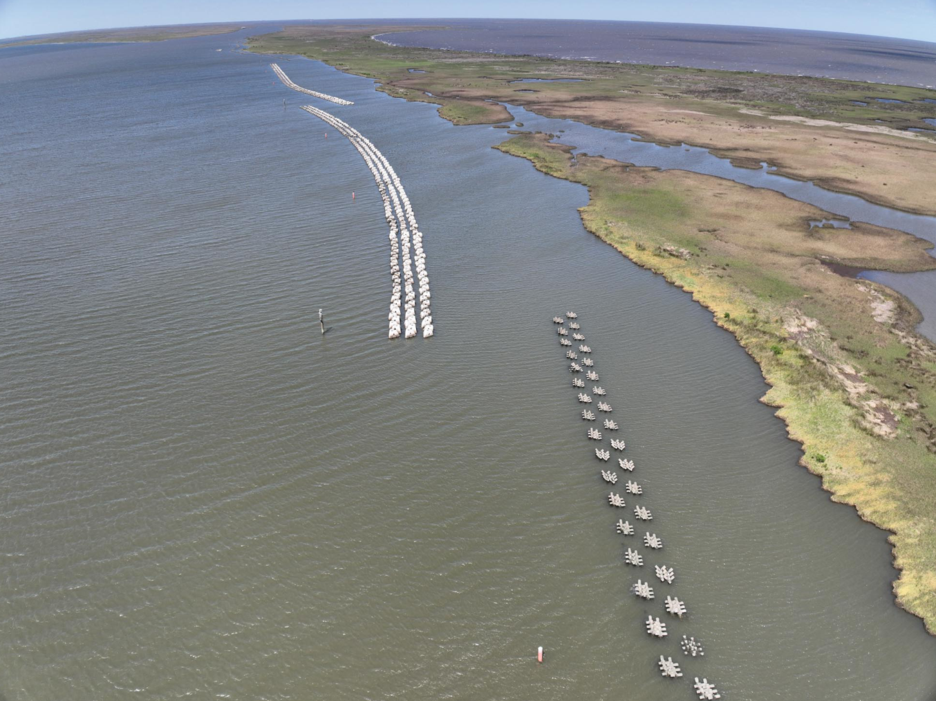
This project (PO-0174) was designed to provide protection to the eroding shoreline of the marshes in St. Bernard Parish, Louisiana, near the mouth of Bayou La Loutre, a previous distributary bayou of the Mississippi River into the Breton and Chandeleur Sound. The project encompasses approximately 11.5 miles of shoreline along the northern shore of Eloi Bay and is only accessible by boat.
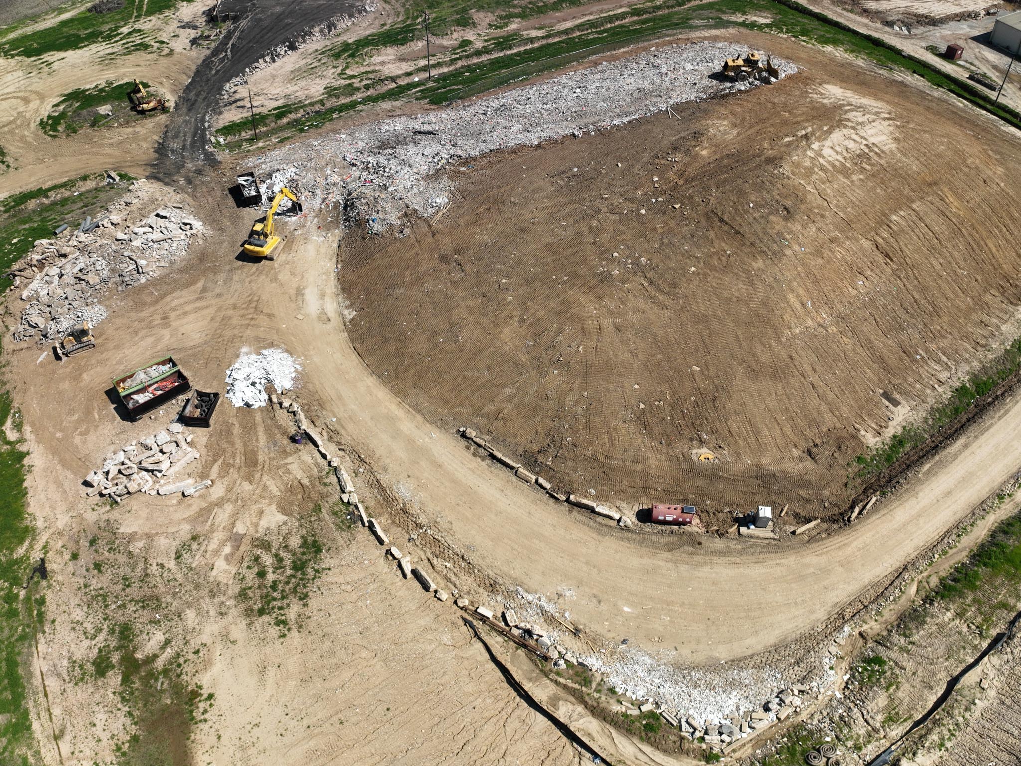
Services provided: Surveying and Environmental Compliance Location: St. Martin Parish, LA Completion date: February 2024 Client: Greenpoint, Inc. Providence prepared a final cap certification […]
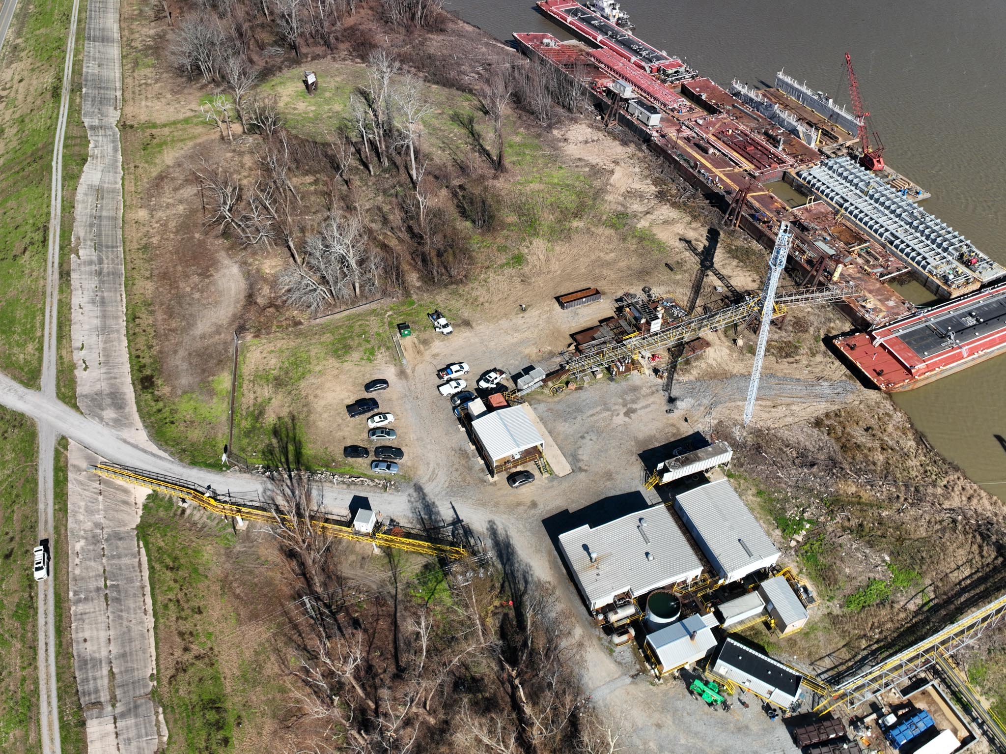
Services provided: Surveying, Permitting, and Engineering Design Location: Ascension Parish, LA Completion date: January 2024 Client: T.T. Barge T. T. Barge is upgrading the access and […]
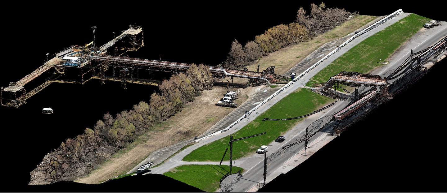
Client: Energy Sector Location: ORLEANS PARISH, LA Providence conducted topographic and bathymetric surveys of the Mississippi River and adjacent batture, levee, and surrounding areas in order […]